***Warning: I am about to step onto a soapbox like I have not heretofore done on my blog. So, hide your kids and hide your wife.
I simply cannot take it anymore
I grew up in the shadows of the Wasatch. I moved away. But I returned, and the Wasatch are a big part of why I returned. The Wasatch are under attack and it is time to stand up and speak out. You have probably heard me rant (in person or via Facebook) about SkiLink, the proposal which would place lift towers and gondolas between The Canyons resort, in Summit County, up and over the Wasatch Crest, and down into the heart of Big Cottonwood Canyon and Solitude resort, in Salt Lake County. There are so many things repugnant about SkiLink that I don’t know where to begin.
As Talisker, the parent company of The Canyons, and Solitude increase efforts to form a coalition of the willing, we are at the point where I must publish my opposition–a sort of cleansing of the hands–for we simply must stop SkiLink, and with it save the Wasatch which, once lost, may never be regained. Here is why I oppose SkiLink and why some call me a tree hugger:
1. SkiLink is not about transportation.
Modern transportation systems must quickly move the highest number of people possible at the lowest possible cost while minimizing impacts on sensitive natural elements. SkiLink fails. I agree that SkiLink has the potential to move a high number of people; however, SkiLink is at a great cost (both direct and external), and one must consider the realities of SkiLink. Perhaps Andrew McLean, the world-reknowned extreme skier and Park City resident put it best:
Let’s see… it starts in a private gated community with limited access, costs $96 per person per day to ride it, creates a donut hole of public property surrounded by private land, crosses a historic scenic trail, crosses a designated scenic highway, forces a sale of public lands that weren’t for sale to begin with, promises to attract 75,000 new skiers a year while at the same time reducing traffic and pollution, and is being proposed by a secretive foreign real estate developer with a questionable local environment track record.
You can read about some of Andrew’s other ideas here: http://goo.gl/0k2IH
Indeed, SkiLink is not about efficient transportation. This video shows the path necessary to get to where SkiLink will begin:
http://vimeo.com/35722395
Nearly $100 and 1.5 hours later, it is clear that SkiLink is not the transportation solution for Park City residents that it purports to be. Rather, SkiLink is a shady land grab of public lands by a Canadian real estate developer with a questionable environmental track record. It is also an expansion of my least favorite Utah ski resort (The Canyons) into my favorite (Solitude, which I will no longer ski if SkiLink becomes a reality). There are many transportation solutions that are much more feasible (and palatable) than selling some of the Wasatch’s prime land to foreign interests. Hike Willow Heights with me this spring and I think you’ll agree.
2. SkiLink is not smart growth.
SkiLink and other interconnect proposals, paving Guardsman (yuck), trains, busses, tunnels–these are some of the many ideas about how to get skiers to/from/between Park City, BCC, and LCC. Some ideas are practical, some are impractical, some are well intentioned, and some are SkiLink. If we are heading down the (perhaps inevitable) road to interconnected ski resorts, we must consider all proposals and select those that have the greatest likelihood of long term success and that minimize impacts on the Wasatch–the place from which our drinking water flows and to which we flee to escape the stresses of urban life. SkiLink may be the best solution for a ski resort trying and grow and gain access to hundreds of acres of additional terrain, but it is a poor solution for an economy and public who depend on Wasatch for tourism, recreation, and finding oneself. There are many proposals out there (including those mentioned by Andrew McLean in the article linked to above), and they deserve serious consideration before Talisker acquires 30 prime acres of USFS land.
3. SkiLink sets a dangerous precedent.
Utah legislators speak frequently and fervently about the necessity to “take back” public lands, returning them to the people, etc. These are the same legislators who purport to favor a strict and unyielding interpretation of the Constitution, which, by the way, contains the Supremacy Clause. Of course, the Utah Legislature’s own researchers and lawyers told them that H.B. 148 has “a high probability of being declared unconstitutional,” but the legislature went ahead and allocated $3,000,000 of our tax dollars to litigate and try to “get back” land from the federal government.
That issue is not directly tied to SkiLink, but the concept is. We have a congressional delegation who again wants to free the federal government of prime land in exchange for money. Money which, once received, will certainly be inefficiently disposed of–it will quickly disappear, but the scar on the Wasatch will remain for generations. This is all being done without public input.
In this interesting take, Tom Wharton summarized it well:
What about Utah’s congressional delegation? Our representatives spend much of their careers crying about how the oppressive federal government prevents the state from developing its resources as quickly as possible by putting controlling mandates on local government. Then most of the delegation sponsors a bill that goes against the wishes of the elected governments of Salt Lake City and County to force the U.S. Forest Service to give up 30 acres of public land for an ill-advised ski lift to connect the Canyons and Solitude ski resorts. How do you spell hypocrisy?
One way to spell hypocrisy is S-k-i-L-i-n-k.
Now, if you are unaware, most ski resorts are located on USFS land. This means that the ski resort operators own the lift towers, chairs, and other improvements, but the USFS owns the land (which the ski resort operators lease from the USFS). Obtaining a permit to use USFS land for ski resorts involves a number of steps, including public comment/hearing periods. Talisker assumed this process would be much to difficult, so they instead convinced Rep. Bishop, Rep. Chaffetz, and Senators Hatch and Lee to support a bill which will sell a 30 acre strip of land, which land was not otherwise for sale, to Talisker, a Canadian real estate development company with a spotty environmental track record.
Talisker did not even try the NSFS permit route. Instead, as one article put it: “It’s ironic — or perhaps the word is hypocritical — because this effort to circumvent local input is coming from the loudest proponents of local control and state’s rights in Congress, who regularly scrap with Uncle Sam over the use of federal lands in the Beehive State.”
In other words, Utah’s congressional delegation, minus Matheson (of course), agreed with Talisker that it would be too difficult and time consuming to try to obtain the USFS permit for which Talisker never applied, and rather than hearing any objections from the locals who live within the shadows (tint) of the Orange Bubble (see below), they found a way to get what they want (even better for them, actually, because the fee simple is the full bundle of sticks, vs. the permit or lease with is something less–visit a real property law class in law school for more discussion about the bundle of sticks).
The dangerous precedent is this: If a wealthy developer can get the ear of a congressperson (money talks), then the entire regime established to ensure orderly growth within the confines of a system designed to get input from all parties, review potential adverse environmental impacts, etc. can be set aside. Not good. Think for a minute about what that means.
What is to stop someone from getting prime land to throw up a development (which, after all, will bring property tax revenues to the state coffers)? Where does your water come from? Who controls it? (If you live in Salt Lake County, chances are that your drinking water comes from the Wasatch canyons, and even from the very area proposed to be sold to Talisker.) It doesn’t take much of an imagination to see where SkiLink’s precedent could lead. How about roller coasters up and down Mount Superior? Wait–I think they’re already working on something like that.
4. Stopping SkiLink is our only chance to save this land.
Again, SkiLink is a proposal which would sell 30 prime acres to a foreign real estate developer. Once this land is sold/developed, it is gone and we aren’t getting it back! Those towers will be there until well after we die.
5. Utah’s economy depends on the environment.
Now, let me turn my focus from the narrow issue of SkiLink to a more general discussion of the environment. Utah’s economy depends on travel and tourism. In fact, in 2009, 19.4MM visitors brought more than $6B into Utah, supporting over 110k jobs, and bringing in $625MM in taxes.
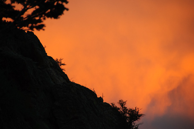
Do visitors come from all over the world to experience the magnificent inversion?

If you are not familiar with the inversion, it is a weeks-to-months-long event in which cold/heavy air gets trapped on the valley floor by a layer of warmer air on top. It feels like a perpetual fog signaling an impending storm–but it is simply a toxic cloud of pollution that blocks the sun and burns the respiratory system. In the picture to the left, all of the pretty colors are the result of pollution. In fact, the pollution in Salt Lake County gets so bad that exercising outside can be as bad for your lungs as smoking a pack of cigs. People don’t come here to see a spoiled environment–they come here to explore wide-open spaces, see the sun during the winter (something not generally possible in much of the country [at least not in Ohio between November and March]), and reconnect with Mother Earth.
Poor air quality, degraded resources, uncontrolled growth, etc. threaten tourism, and a threat to Utah’s tourism industry is a threat to one of Utah’s greatest economic machines. For that reason alone, we should do our best to preserve the mountains that surround Salt Lake City and make it such a great place to live. (Don’t buy the “projections” the SkiLink proponents have thrown around–there are plenty of counters that throw those projections into question.)
6. Protection of the environment is an end in itself; or, what will it look like tomorrow?
Have you hiked Donut Falls lately? Years ago, I found Donut Falls to afford some degree of solitude. Sure, it was heavily traveled and visitors were frequent. But, when I hiked Donut Falls again last year, we found people parking all over trampled vegetation, a number of people with dogs (in the BCC watershed, where they are many, many signs warning that dogs are prohibited), etc. It was so busy and had turned into such a Disneyland of sorts that Ali, the (then) three boys, and I turned around before we reached the end–we could not make it through the wall-to-wall people.
We left and headed for Willow Heights, and what a contrast! The narrower, steeper, and more imposing trail thinned the crowds, and even on a busy weekend we were able to enjoy the sort of solitude that compels one to leave the valley for the mountains. Unhindered development, SkiLink, and other issues threaten to destroy areas like this and the beauty that makes Utah unique. There are several ways to protect the Cottonwood Canyons and Utah’s beauty generally. That beauty is worth saving for ourselves, our children, and their children.
Fine, but what can I do?
– Call and email your representatives:
Rob Bishop
Jason Chaffetz
Orrin Hatch
Mike Lee
Utah Legislature
– Donate time and money to Save Our Canyons
– Join Stop The Tram on Facebook
– Support candidates for office who care about the environment, like Ben McAdams (you can read Ben McAdams’ editorial about SkiLink here: http://goo.gl/M6jNb) and Jim Matheson
Done with the soapbox.
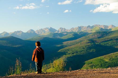
Okay, that was intense. Last summer, Noah and I backpacked to Lake Blanche (see the post below for details). Noah talks about it constantly, and he and his brothers marvel at the beauty that surrounds us. Here is proof (from a different hike):
This summer, I will take Noah and Logan to Willow Heights, where we will spend the night, practice the principles of Leave No Trace, and talk about how the beauty surrounding them may forever be scarred with towers, wires, and gondolas courtesy of the people who brought us the Orange Bubble.

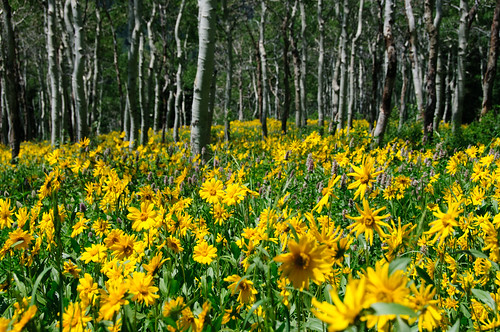
The Orange Bubble folks hardly seem like a worthy companion to Willow Heights, a very small portion of which looks like this:
The rest of Willow Heights has streams, mountains, ponds, etc., like this:
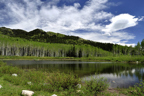
(courtesy Christian Paul)
We will take pictures so that they can show their own children and grandchildren how pristine Willow Heights used to be (one of the most beautiful areas I know of, which also happens to be within a 30 minute drive from Salt Lake City), before greed took over and poor planning resulted. My parents instilled in me a love for all things outdoors, and it is our duty to do the same for our children and to protect something for them and their children to enjoy.
Then they can tell their children and grandchildren that we did not care enough to save it for their generations–but instead, we decided that, rather than needing to hike the quick .75 miles from the road to the lake, they can now see the lake by driving to Park City, taking 5 chair lifts (at a cost of nearly $100 per person in 2012 dollars), hopping on SkiLink, and viewing Willow Heights from within the confines of an orange bubble. That sounds much more enjoyable, doesn’t it?
We only have one Earth, and I hope you will join me in being a good steward of it.
Thank you, and Happy Earth Day.
* I have chosen not to publish the location of the Willow Heights trailhead in hopes it can keep some solitude. If you want to visit with me, leave me a comment and I will be happy to take you there. The place speaks for itself, and I promise not to take my soapbox with me! (By the way, I know that SkiLink will not run through Willow Heights, but it will impact a similar area and be visible from Willow Heights.)
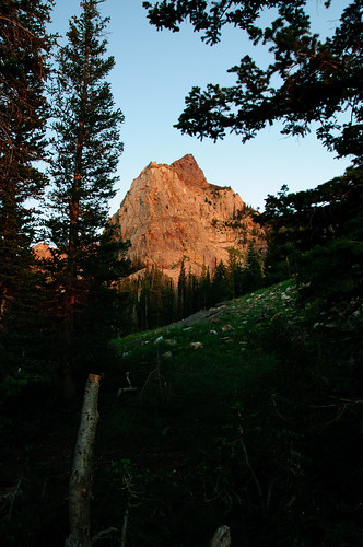
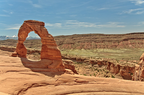
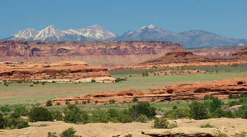
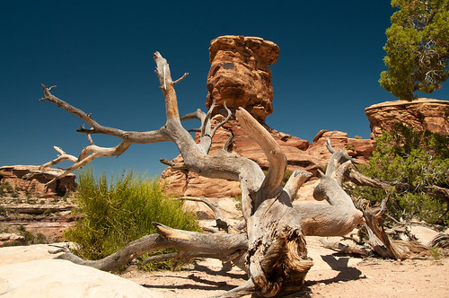
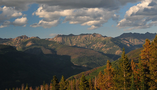
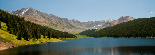
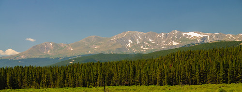
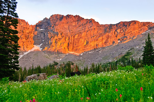
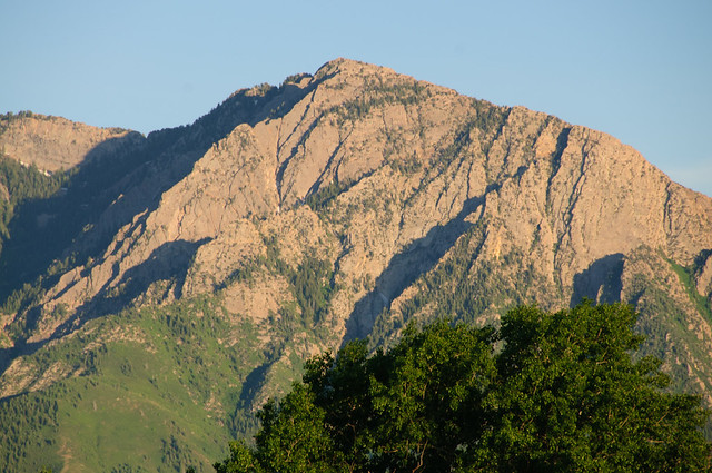
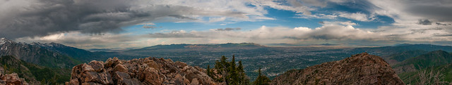
* Below are some pictures of the beauty that surrounds us in the West and that I think is worth preserving (these are not Willow Heights–just beautiful areas we should protect for the future)